School nearby Colegio Carmen Mealla
Bolivia
School nearby Colegio Carmen Mealla
Colegio Carmen Mealla
Tarija Bolivia
contacts phone
:
+591
Latitude:
-21.5321761
, Longitude:
-64.7408847
read more
nearest School
251 m
Colegio Aniceto Arce
Guadalquivir, Tarija
School
read more
344 m
ETC
Ramon Rojas, Tarija
School
read more
375 m
Instituto CCA Del SUR
La Madrid, Tarija
School
read more
489 m
Colegio Santa Ana
La Madrid 505, Tarija
School
read more
489 m
Santa Ana College
La Madrid 505, Tarija
School
read more
490 m
Guarderia Sol En Mi Jardin
El Molino, Tarija
School
read more
548 m
Colegio Nacional San Luis Tarija
Calle Ingavi entre Campero y Saracho, Ingavi, Tarija
School
read more
548 m
San Luis Tarija National College
Calle Ingavi entre Campero y Saracho, Ingavi, Tarija
School
read more
579 m
Escuela de Musica Regional Pasor Achá Martinez
El Molino, Tarija
School
read more
683 m
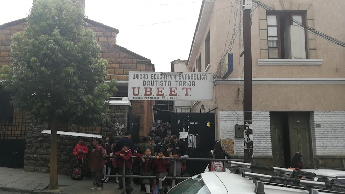
Unidad Educativa Ubeet
Tarija
School
read more
696 m
Colegio Privado UBEET
Juan Misael Saracho, Tarija
School
read more
726 m
Col Nal Eustaquio Mendez
General Trigo, Tarija
School
read more
734 m
Colegio Nacional Eustaquio Mendez
El Molino, Tarija
School
read more
837 m
Colegio San Bernardo de Tarija
Corrado 339, Tarija
School
read more
861 m
Escuela Madre Teresa de Calcuta
Calle 11, Tarija
School
read more
866 m
DDE Tarija
Avenida Victor Paz Estensoro, Tarija
School
read more
882 m
Colegio Hna Teresa de Calcuta
Libertad, Tarija
School
read more
890 m
Unidad Educativa Teresa de Calcuta
Tarija
School
read more
950 m
Colegio Bernardo Navajas Trigo
Tarija
School
read more
974 m
U.E. Jorge Araoz Campero
La Loma, Tarija
School
read more
977 m
Unidad Educativa Humberto Portocarrero 1
La Loma, Tarija
School
read more
982 m
Colegio Humberto Purporto Carreño Y Jorge Araoz Campero
Tarija
School
read more
1.035 km
Liceo Campero
Tarija
School
read more
1.075 km
GRACE & MUSIC TARIJA
Ecuador, Tarija
School
read more
1.318 km
Unidad Educativa Bolivia
Tarija
School
read more
📑
all categories
Accounting
Administrative area level 1
Administrative area level 2
Airport
Amusement park
Aquarium
Art gallery
Atm
Bakery
Bank
Bar
Beauty salon
Bicycle store
Book store
Bowling alley
Bus station
Cafe
Campground
Car dealer
Car rental
Car repair
Car wash
Casino
Cemetery
Church
City hall
Clothing store
Colloquial area
Convenience store
Courthouse
Dentist
Department store
Doctor
Electrician
Electronics store
Embassy
Finance
Fire station
Florist
Food
Funeral home
Furniture store
Gas station
General contractor
Grocery or supermarket
Gym
Hair care
Hardware store
Health
Hindu Temple
Home goods store
Hospital
Insurance agency
Jewelry store
Laundry
Lawyer
Library
Light rail station
Liquor store
Local government office
Locality
Locksmith
Lodging
Meal delivery
Meal takeaway
Mosque
Movie rental
Movie theater
Moving company
Museum
Natural feature
Neighborhood
Night club
Painter
Park
Parking
Pet store
Pharmacy
Physiotherapist
Place of worship
Point of interest
Police
Political
Post office
Premise
Real estate agency
Restaurant
Roofing contractor
Route
Rv park, camping
School
Shoe store
Shopping mall
Spa
Stadium
Storage
Store
Subway station
Supermarket
Synagogue
Taxi stand
Train station
Transit station
Travel agency
University
Veterinary care
Zoo
administrative area level 4
sublocality level 1
↑