Lodging nearby Casa Del Tio
Bolivia
Lodging nearby Casa Del Tio
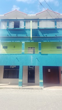
Casa Del Tio
Unnamed Road, Montero, Bolivia
contacts phone
:
+591 73131517
Latitude:
-17.322671
, Longitude:
-63.241348
larger map & directions
read more
nearest Lodging
1.654 km
HOTEL FLORIDA
Unnamed Road, Montero
Lodging
read more
1.733 km
Alojamiento Franco
Montero
Lodging
read more
2.014 km
Residencial Avenida
Montero
Lodging
read more
2.184 km
Residencial Damaris
Montero
Lodging
read more
2.207 km
Dm
Montero
Lodging
read more
2.242 km
Motel Las Vegas
Montero
Lodging
read more
2.279 km
Residencial 1ro de Noviembre
Montero
Lodging
read more
2.306 km
Alojamiento Tropical
Prolongación Pastor Díaz, Montero
Lodging
read more
2.311 km
Alojamiento Isa
Avenida Pampa de La Madre, Montero
Lodging
read more
2.349 km
JALDIN BOLIVAR
Ruta Nacional 4, Montero
Lodging
read more
2.393 km
Alojamiento
Montero
Lodging
read more
2.399 km
Alojamiento Don Matias
Jose Cuellar, Montero
Lodging
read more
2.441 km
Hostal del Oriente
Montero
Lodging
read more
2.632 km
Hotel Jaldin Bolivar II * *
Montero
Lodging
read more
2.755 km
Julio Cesar Meneses
Calle Napoleón Hurtado 344, Montero
Lodging
read more
2.761 km
Residencial Central
Montero
Lodging
read more
2.926 km
Alojamiento Paraiso
Avenida Betania, Montero
Lodging
read more
3.119 km
Pinocho
Calle Warnes 288, Montero
Lodging
read more
3.129 km
El Pinocho Alojamiento
Calle Warnes, Montero
Lodging
read more
3.152 km
Don Alberto
Unnamed Road,, Montero
Lodging
read more
3.175 km
alojamiento Palma
Rafael Terrazas, Montero
Lodging
read more
3.336 km
Hotel karlinton
Montero
Lodging
read more
3.899 km
MOTEL LA DIOSA DEL AMOR
Montero
Lodging
read more
4.104 km
Motel paraiso
Montero
Lodging
read more
5.362 km
Cabaña Todos Santos Hirtner
Bolivia
Lodging
read more
📑
all categories
Accounting
Administrative area level 1
Administrative area level 2
Airport
Amusement park
Aquarium
Art gallery
Atm
Bakery
Bank
Bar
Beauty salon
Bicycle store
Book store
Bowling alley
Bus station
Cafe
Campground
Car dealer
Car rental
Car repair
Car wash
Casino
Cemetery
Church
City hall
Clothing store
Colloquial area
Convenience store
Courthouse
Dentist
Department store
Doctor
Electrician
Electronics store
Embassy
Finance
Fire station
Florist
Food
Funeral home
Furniture store
Gas station
General contractor
Grocery or supermarket
Gym
Hair care
Hardware store
Health
Hindu Temple
Home goods store
Hospital
Insurance agency
Jewelry store
Laundry
Lawyer
Library
Light rail station
Liquor store
Local government office
Locality
Locksmith
Lodging
Meal delivery
Meal takeaway
Mosque
Movie rental
Movie theater
Moving company
Museum
Natural feature
Neighborhood
Night club
Painter
Park
Parking
Pet store
Pharmacy
Physiotherapist
Place of worship
Point of interest
Police
Political
Post office
Premise
Real estate agency
Restaurant
Roofing contractor
Route
Rv park, camping
School
Shoe store
Shopping mall
Spa
Stadium
Storage
Store
Subway station
Supermarket
Synagogue
Taxi stand
Train station
Transit station
Travel agency
University
Veterinary care
Zoo
administrative area level 4
sublocality level 1
↑