Police nearby Policía Boliviana Oficina de Transito
Bolivia
Police nearby Policía Boliviana Oficina de Transito
Policía Boliviana Oficina de Transito
Sudoeste, Cochabamba, Bolivia
contacts phone
:
+591
Latitude:
-17.4052193
, Longitude:
-66.1678322
larger map & directions
read more
nearest Police
102 m
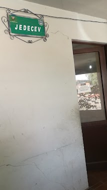
POLICIA BOLIVIANA OFICINA DE JEDECEV CBBA
Cochabamba
Police
read more
1.171 km
Estación Policial Integral (EPI)
Cochabamba
Police
read more
1.205 km
Batallon de Seguridad Fisica, Policia Boliviana
Cochabamba
Police
read more
1.332 km
inspeccion tecnica
Guerrilleros, Cochabamba
Police
read more
1.768 km
Comando Departamental De Policía
Plaza 14 de Septiembre., Cochabamba
Police
read more
1.801 km
Utop
Cochabamba
Police
read more
2.352 km
Fuerza Especial de Lucha Contra el Crimen
Cochabamba
Police
read more
2.36 km
Felcc
Cochabamba
Police
read more
3.403 km
FELCN - Cochabamba
y, Beni & Tomas Frias, Cochabamba
Police
read more
3.403 km
FELCN - Cochabamba
y, Beni, Cochabamba
Police
read more
4.153 km
EPI Coña Coña
Cochabamba
Police
read more
4.332 km
EPI SUR
Cochabamba
Police
read more
4.82 km
Epi Norte
Cala Cala, Cochabamba
Police
read more
5.335 km
Modulo Policial Epi2
Unnamed Road, Cochabamba
Police
read more
6.077 km
DELTA Unit Bolivian Police
Nte, Cochabamba
Police
read more
6.29 km
DIPROVE - Dirección de Prevención de Robo de Vehículos
Cochabamba
Police
read more
7.238 km
POSTA POLICIAL N° 11
Urb. San Andres, Cochabamba
Police
read more
7.238 km
POSTA POLICIAL N° 11
Urbanización San Andres, Cochabamba
Police
read more
8.484 km
Policia de Tiquipaya
Tiquipaya
Police
read more
10.472 km
POLICIA MILITAR CBBA
POLICIA MILITAR CBBA
Police
read more
11.912 km
Policia Transito
Quillacollo
Police
read more
12.117 km
FELCC
CALLE, Cochabamba
Police
read more
12.756 km
Policia
Camino al Paso
Police
read more
13.232 km
DIPROVE Dirección de Prevención de Robo de Vehículos
Sacaba
Police
read more
14.34 km
Transito Sacaba
Sacaba
Police
read more
📑
all categories
Accounting
Administrative area level 1
Administrative area level 2
Airport
Amusement park
Aquarium
Art gallery
Atm
Bakery
Bank
Bar
Beauty salon
Bicycle store
Book store
Bowling alley
Bus station
Cafe
Campground
Car dealer
Car rental
Car repair
Car wash
Casino
Cemetery
Church
City hall
Clothing store
Colloquial area
Convenience store
Courthouse
Dentist
Department store
Doctor
Electrician
Electronics store
Embassy
Finance
Fire station
Florist
Food
Funeral home
Furniture store
Gas station
General contractor
Grocery or supermarket
Gym
Hair care
Hardware store
Health
Hindu Temple
Home goods store
Hospital
Insurance agency
Jewelry store
Laundry
Lawyer
Library
Light rail station
Liquor store
Local government office
Locality
Locksmith
Lodging
Meal delivery
Meal takeaway
Mosque
Movie rental
Movie theater
Moving company
Museum
Natural feature
Neighborhood
Night club
Painter
Park
Parking
Pet store
Pharmacy
Physiotherapist
Place of worship
Point of interest
Police
Political
Post office
Premise
Real estate agency
Restaurant
Roofing contractor
Route
Rv park, camping
School
Shoe store
Shopping mall
Spa
Stadium
Storage
Store
Subway station
Supermarket
Synagogue
Taxi stand
Train station
Transit station
Travel agency
University
Veterinary care
Zoo
administrative area level 4
sublocality level 1
↑