School nearby Iglesia "Dios Es Amor" U.C.E.
Bolivia
School nearby Iglesia "Dios Es Amor" U.C.E.
Iglesia "Dios Es Amor" U.C.E.
Tarija Bolivia
contacts phone
:
+591
Latitude:
-21.5216056
, Longitude:
-64.7441312
read more
nearest School
121 m
Fe y Alegria
Unnamed Road, Tarija
School
read more
240 m
CEADI
Avenida de la Integracion, Tarija
School
read more
250 m
Escuela Municipal De Raquet
Tarija
School
read more
255 m
Unuvercidad Juan Misael Zaracho
Rotonada de la UAJMS, Tarija
School
read more
475 m
Colegio Humberto Purporto Carreño Y Jorge Araoz Campero
Tarija
School
read more
484 m
Unidad Educativa Humberto Portocarrero 1
La Loma, Tarija
School
read more
487 m
U.E. Jorge Araoz Campero
La Loma, Tarija
School
read more
520 m
Ing Data
Tarija
School
read more
525 m
Colegio Bernardo Navajas Trigo
Tarija
School
read more
539 m
Colegio Elogió Ruiz
Tarija
School
read more
555 m
U.E. Lidea Reynoso de Campos
Tarija
School
read more
562 m
U.E. Eulogio Ruiz
Froilan Tejerina, Tarija
School
read more
916 m
Centro De Educación Alternativa San Antonio
IV Centenario, Tarija
School
read more
917 m
Jesus of Nazareth College
Tarija
School
read more
954 m
Escuela Fe Y Alegria
IV Centenario, Tarija
School
read more
960 m
GRACE & MUSIC TARIJA
Ecuador, Tarija
School
read more
974 m
U. E. Aniceto Arce
Guadalquivir, Tarija
School
read more
978 m
Colegio Aniceto Arce
Guadalquivir, Tarija
School
read more
1.16 km
Escuela santa ana de tarija bolivis
Ballivián, Tarija
School
read more
1.227 km
Iglesia Fuente De Vida
Ramon Rojas, Tarija
School
read more
1.265 km
Colegio San Roque
Tarija
School
read more
1.288 km
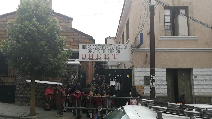
Unidad Educativa Ubeet
Tarija
School
read more
1.319 km
Colegio Privado UBEET
Juan Misael Saracho, Tarija
School
read more
1.515 km
Guarderia Sol En Mi Jardin
El Molino, Tarija
School
read more
1.566 km
CIM LUIS ANSELMO FARFAN Q.
Avaroa, Tarija
School
read more
📑
all categories
Accounting
Administrative area level 1
Administrative area level 2
Airport
Amusement park
Aquarium
Art gallery
Atm
Bakery
Bank
Bar
Beauty salon
Bicycle store
Book store
Bowling alley
Bus station
Cafe
Campground
Car dealer
Car rental
Car repair
Car wash
Casino
Cemetery
Church
City hall
Clothing store
Colloquial area
Convenience store
Courthouse
Dentist
Department store
Doctor
Electrician
Electronics store
Embassy
Finance
Fire station
Florist
Food
Funeral home
Furniture store
Gas station
General contractor
Grocery or supermarket
Gym
Hair care
Hardware store
Health
Hindu Temple
Home goods store
Hospital
Insurance agency
Jewelry store
Laundry
Lawyer
Library
Light rail station
Liquor store
Local government office
Locality
Locksmith
Lodging
Meal delivery
Meal takeaway
Mosque
Movie rental
Movie theater
Moving company
Museum
Natural feature
Neighborhood
Night club
Painter
Park
Parking
Pet store
Pharmacy
Physiotherapist
Place of worship
Point of interest
Police
Political
Post office
Premise
Real estate agency
Restaurant
Roofing contractor
Route
Rv park, camping
School
Shoe store
Shopping mall
Spa
Stadium
Storage
Store
Subway station
Supermarket
Synagogue
Taxi stand
Train station
Transit station
Travel agency
University
Veterinary care
Zoo
administrative area level 4
sublocality level 1
↑